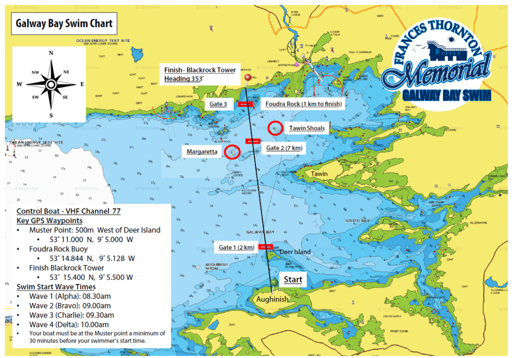
The swim from Aughinish in Co. Clare to Blackrock Diving Tower in Salthill is a distance of 10.5 km as the crow flies. However, it is not a straight crossing as swimmers have to swim West of Deer Island at the start and then navigate across the bay. In addition, due to currents, wind, and tidal ranges of up to 5 metres in Galway Bay, swimmers can cover a distance of up to 13 km on the crossing. Swimmers should factor this into their training plans. Swimmers will start in Aughinish Co. Clare and meet with their boats at the swimmer pick-up zone which is marked by a set of buoys located between the start at Auginish for a distance of 1 km towards Deer Island.
There are three swim gates that indicate the course swimmers should take across the bay.
- Gate 1 – @ 2km mark – 100 m West of Deer Island
- Gate 2 – @ approx. the 7km mark – between Magaretta and the Tawin shoals buoy.
- Gate 3 – 50 m West of Foudra Rock buoy (South Cardinal Mark)
Each swimmer must swim within 50 metres of the three gates on the crossing. These gates mark the swim course and are mandatory for all boat captains and swimmers for safety and logistical reasons.